Banff, Canada 2007
PhotosAltitude Profiles
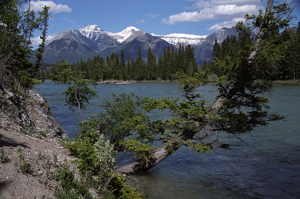
Hoodoos Trail: Bow river naturally splits Banff into south-west and north-east parts, Fairholme Range in the background.
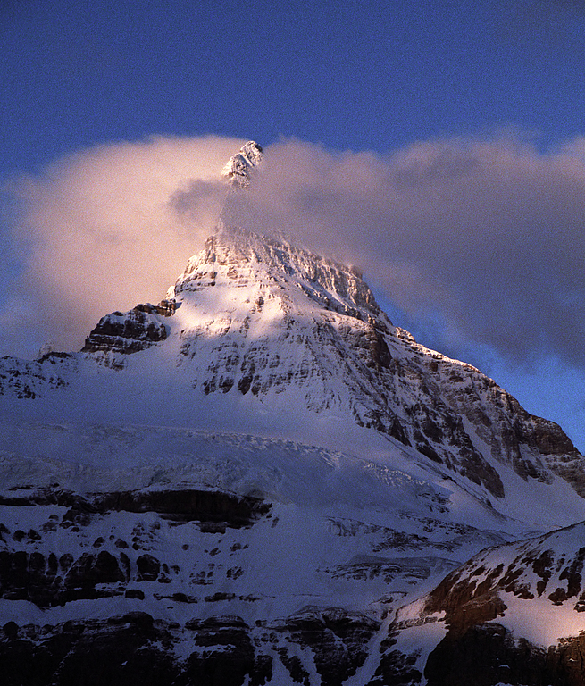
Mount Assiniboine (3618m), "canadian Matterhorn", more than 1500m above the frozen Lake Magog.
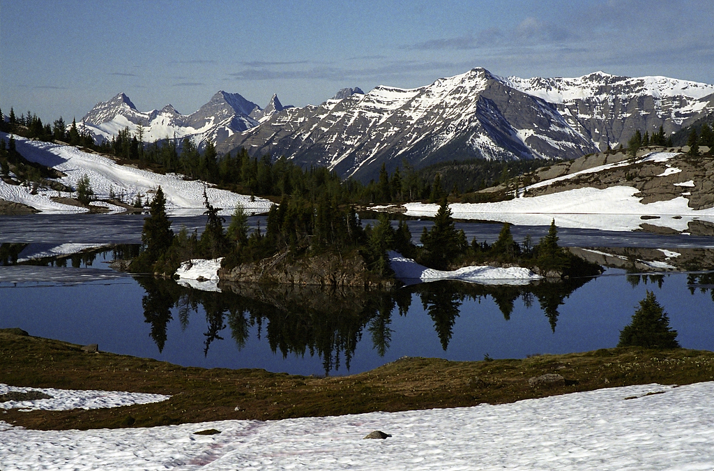
Rock Isle Lake and large Ball Range, which forms the Continental Divide of the Americas.
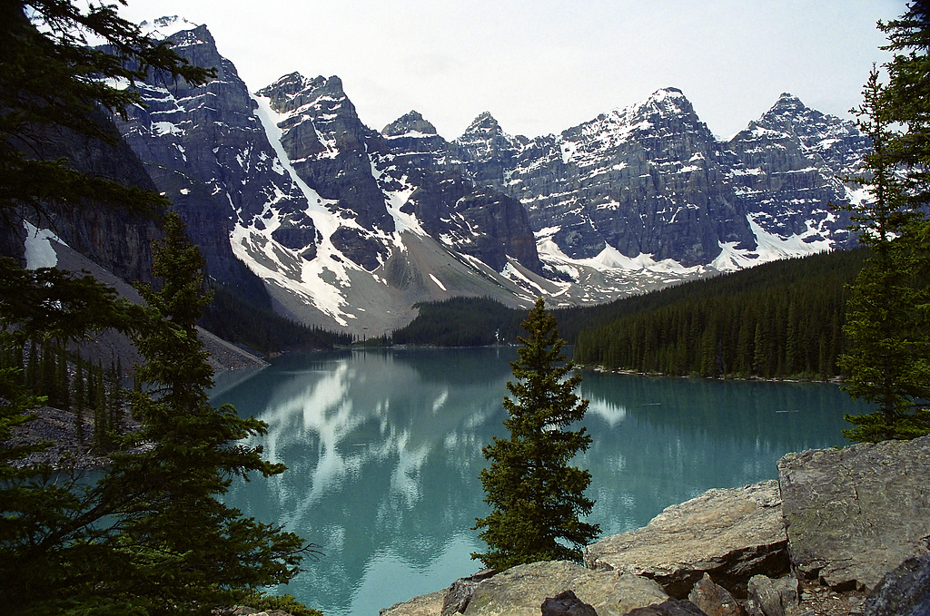
Unforgettably turquoise Moraine Lake surrounded by mountains over 3000m in the Valley of the Ten Peaks.
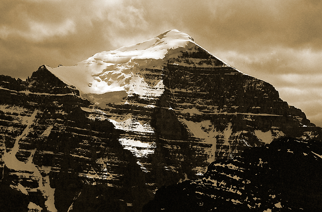
Mount Temple (3544m), uncompromising sanctuary of nature. The northern wall (depicted) was not climbed until 1960.
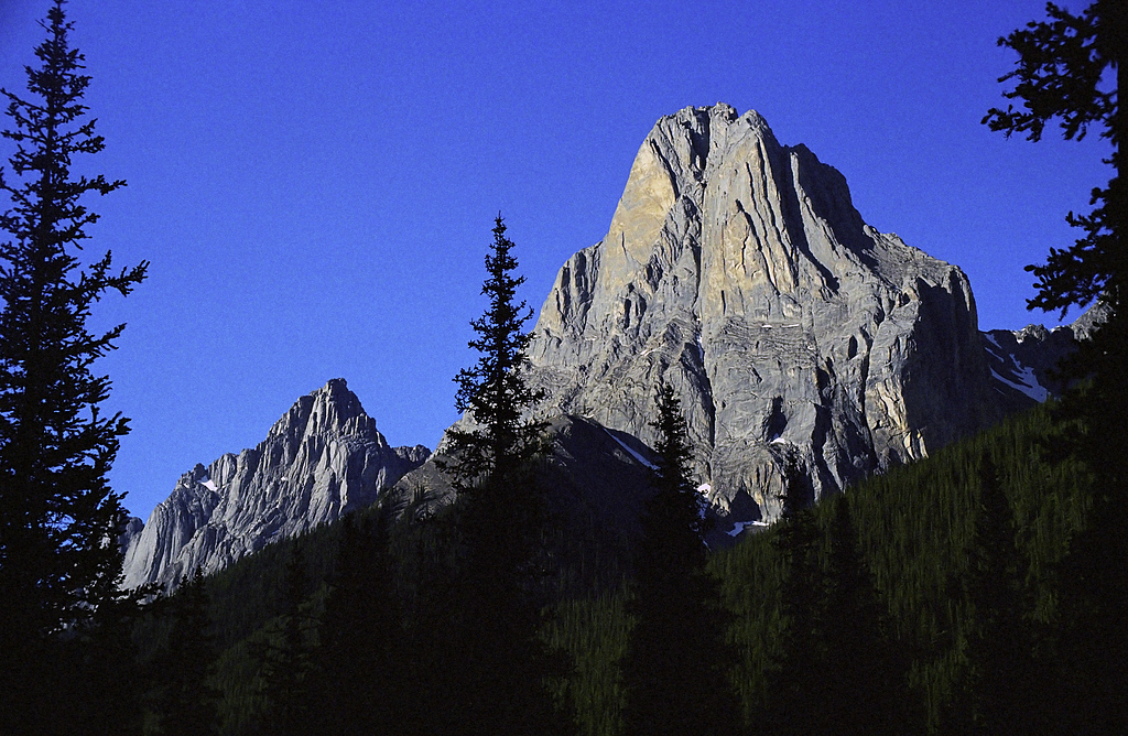
Limestone monolith Mount Louis (2682m) in the Sawback Range magically attracts mountaineers and lightnings.